I will be in Amsterdam in July for a week, and am trying to decide the best way to go regarding using public transit. Not sure how much I will be using the buses, trams and metro, but was there 2 years ago, and walked everywhere, and was exhausted after just a few days. How tough is it manage the trams, buses etc ? I have a lousy sense of direction. Will be staying in the Dam Square area. Any input by you savvy travelers would be greatly appreicated.
The streets in the very center of Amsterdam are laid out in a circular pattern around the canals, so yes it can indeed be a very disorienting place to visit. It's very walkable but using the trams a bit can save the wear and tear on your feet;) The best advice I can give you is to get a tram map of the city center from the GVB office across the tram tracks in front of centraal station and use it as a reference from which lines take. I've been to Amsterdam 15+ times, and even I still have to carry such a map, since there are so many different lines which cris-cross the city, it's hard to memorize them all. Since you'll be staying in the Dam area you could walk to various site and take the tram back to your hotel. Most all trams with "Centraal Station" as it's final destination on the sign in front will pass through Dam Sqaure before reaching the train station. Half the lines will drop you off in front of the royal palace, the other half in back where the Albert Heijn Supermarket is located. Here's the site for the transit agency with info to get you started:
http://en.gvb.nl/ovinmamsterdam/attracties/Pages/Dagjeuit.aspx
Thank you Michael for the good information
If you will be there for a week, the best way to go is to get the 7 day card (actually it's called 168 hours) for €32. This way, if you get lost and have to backtrack, you don't have to spend an extra fare. About 2/3 of the trams go back to Central Station.
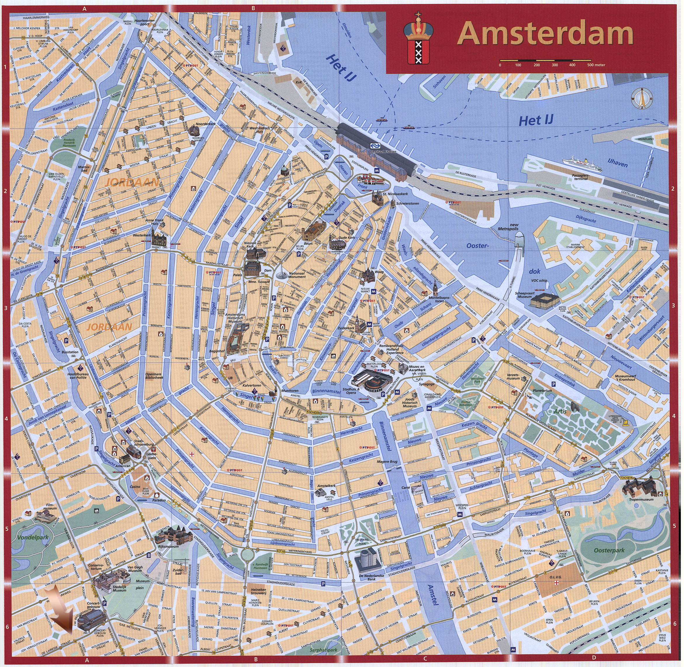
As for getting oriented, I will quote the great description from a 1991 gay and lesbian travel guide, Are You Two...Together? It will be much easier to follow if you are looking at a map. like this one: http://www.orangesmile.com/destinations/img/amsterdam_map_big.jpg
"To orient yourself, picture one of those diagrams of the solar system they always used to show us in science class when we were kids. Chop it in half horizontally, right though the middle of Our Friend Mr. Sun, and throw away the whole top half. What you have left, which should look like a multilined half circle with the straight part on top, is central Amsterdam: The remaining half of Mr. Sun (in the middle of the straight top part) is the Central Rail Station, and the planet orbits semicircling around it are the main ring canals, named, from the inside out, the inner Singel, Herengracht, Keizersgracht, Prinsengracht, and the outer Singel."
The trick for remembering the canals not named Singel: They're in alphabetical order from the center - H, K, P.
I agree with carrying a map. And don't be afraid to ask directions; remember Amsterdammers speak English and are used to visitors.
A 7-day transportation pass is your best bet. You only need to check in and out on the totems when you use any service (tram, bus, subway). Easy and simple. This has also the advantage of allowing you to:
- explore areas that are not very central like the Plantage district, the Amsterdamse Bos etc.
- reducing the total amount of walk, especially as you are going to stay for a whole week
Thanks to all for these great suggestions!